Greenland vs. South America: The Map is Lying to You!
If you look at a standard Google Map or the world map hanging in your old classroom, Greenland looks massive. In fact, it looks almost as big as the entire continent of South America.
But here is the reality check: It’s an optical illusion. Welcome to the most famous “Size Battle” in geography—where what you see is definitely not what you get.
The Tale of the Tape: The Raw Data
When we look at the actual landmass (square mileage), the “battle” ends before it even begins.
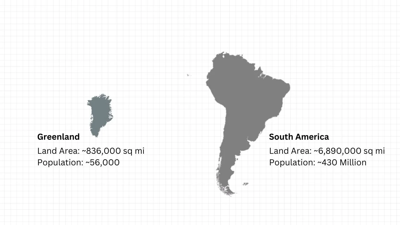
| Feature | Greenland | South America |
| Land Area (Sq. Miles) | ~836,000 sq mi | ~6,890,000 sq mi |
| Land Area (Sq. Km) | ~2.16 Million sq km | ~17.84 Million sq km |
| Population | ~56,000 | ~430 Million |
| Country/Continent | World’s Largest Island | World’s 4th Largest Continent |
The 8x Rule: How Much Bigger is South America?
South America is not just bigger than Greenland—it is 8.2 times larger.
To put that into a visual perspective for your SizeBattle tool:
- You could fit eight Greenlands inside South America, and you would still have enough room left over to fit the state of Texas!
- Brazil alone is 4 times larger than Greenland.
So, Why Does the Map Look So Wrong? (The Mercator Effect)
The reason Greenland looks like a giant on your screen is because of the Mercator Projection.
Back in 1569, Gerardus Mercator designed a map for sailors. Because the Earth is a sphere and a map is flat, he had to stretch the areas near the North and South Poles to keep the directions straight for navigation.
- Objects near the Equator (like South America) stay true to size.
- Objects near the Poles (like Greenland) get stretched out like a piece of gum.
Visualizing the Battle on SizeBattle.com
If you take Greenland and “drag” it down to the Equator next to Brazil:
- The Shrinkage: It suddenly looks like a small island.
- The Reality: Greenland is roughly the size of Mexico.
- The Continent Factor: South America stretches from the Caribbean all the way to the Antarctic circle. It’s a massive landmass that dwarfs Greenland in every possible way.
Final Verdict
- The “Map Winner”: Greenland (thanks to 500-year-old math).
- The “Reality Winner”: South America. It’s a total knockout.